
Bhahai topographic map
Interactive map
Click on the map to display elevation.
About this map
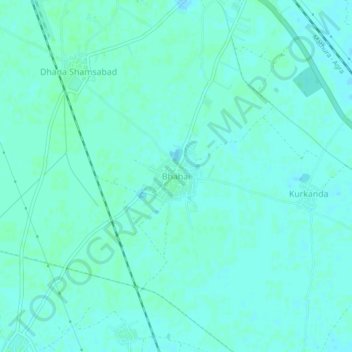
Name: Bhahai topographic map, elevation, terrain.
Location: Bhahai, Mathura, Agra division, Uttar Pradesh, India (27.32379 77.68317 27.36379 77.72317)
Average elevation: 581 ft
Minimum elevation: 571 ft
Maximum elevation: 587 ft
Other topographic maps
Click on a map to view its topography, its elevation and its terrain.
Govardhan
India > Uttar Pradesh > Mathura
Govardhan, Mathura, Agra division, Uttar Pradesh, 281502, India
Average elevation: 594 ft
Mathura
India > Uttar Pradesh > Mathura > Mathura
Mathura, Uttar Pradesh, 281001, India
Average elevation: 581 ft