
Wairakei Village topographic map
Interactive map
Click on the map to display elevation.
About this map
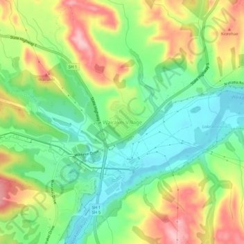
Name: Wairakei Village topographic map, elevation, terrain.
Location: Wairakei Village, Taupo District, Waikato, New Zealand (-38.63940 176.08304 -38.59940 176.12304)
Average elevation: 1,335 ft
Minimum elevation: 1,102 ft
Maximum elevation: 1,667 ft