
Thank you for supporting this site ❤️
Make a donation
Make a donation
Gear up for your next adventure:
As an Amazon Associate, this site earns from qualifying purchases at no extra cost to you.
Hochgurgl topographic map
Click on the map to display elevation.
Thank you for supporting this site ❤️
Make a donation
Make a donation
Gear up for your next adventure:
As an Amazon Associate, this site earns from qualifying purchases at no extra cost to you.
About this map
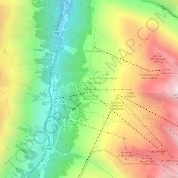
Name: Hochgurgl topographic map, elevation, terrain.
Location: Hochgurgl, Gemeinde Sölden, Bezirk Imst, Tyrol, 6456, Austria (46.87993 11.03143 46.91993 11.07143)
Average elevation: 7,470 ft
Minimum elevation: 5,410 ft
Maximum elevation: 10,026 ft
Thank you for supporting this site ❤️
Make a donation
Make a donation
Gear up for your next adventure:
As an Amazon Associate, this site earns from qualifying purchases at no extra cost to you.