
Nanos topographic map
Interactive map
Click on the map to display elevation.
About this map
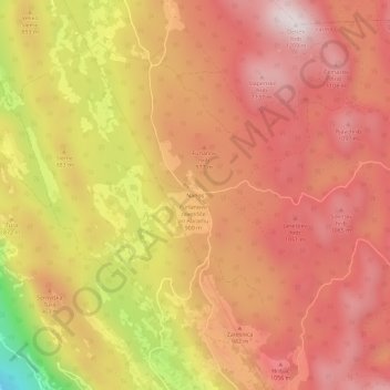
Name: Nanos topographic map, elevation, terrain.
Location: Nanos, Vipava, Slovenia (45.79946 13.99930 45.83946 14.03930)
Average elevation: 2,966 ft
Minimum elevation: 1,152 ft
Maximum elevation: 3,911 ft