
San Sadurniño topographic map
Interactive map
Click on the map to display elevation.
About this map
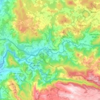
Name: San Sadurniño topographic map, elevation, terrain.
Location: San Sadurniño, Ferrol, La Coruña, Galicia, España (43.46858 -8.11885 43.59345 -7.96776)
Average elevation: 669 ft
Minimum elevation: 0 ft
Maximum elevation: 1,742 ft