
Steamboat Springs topographic map
Interactive map
Click on the map to display elevation.
About this map
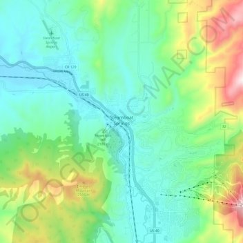
Name: Steamboat Springs topographic map, elevation, terrain.
Location: Steamboat Springs, Routt County, Colorado, USA (40.43940 -106.88685 40.52894 -106.78018)
Average elevation: 7,310 ft
Minimum elevation: 6,617 ft
Maximum elevation: 9,157 ft