
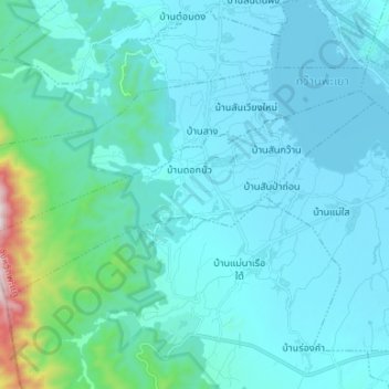
ตำบลบ้านตุ่น topographic map
Interactive map
Click on the map to display elevation.
About this map
Name: ตำบลบ้านตุ่น topographic map, elevation, terrain.
Location: ตำบลบ้านตุ่น, อำเภอเมืองพะเยา, Phayao, Thailand (19.10400 99.75750 19.17120 99.89003)
Average elevation: 1,624 ft
Minimum elevation: 1,280 ft
Maximum elevation: 4,685 ft