
Gonçalo Bocas topographic map
Interactive map
Click on the map to display elevation.
About this map
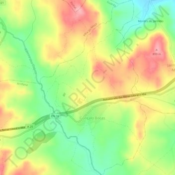
Name: Gonçalo Bocas topographic map, elevation, terrain.
Location: Gonçalo Bocas, Guarda, Centro, Portugal (40.56296 -7.19286 40.60307 -7.16077)
Average elevation: 2,710 ft
Minimum elevation: 2,490 ft
Maximum elevation: 2,940 ft
Other topographic maps
Click on a map to view its topography, its elevation and its terrain.