
Texcapa topographic map
Interactive map
Click on the map to display elevation.
About this map
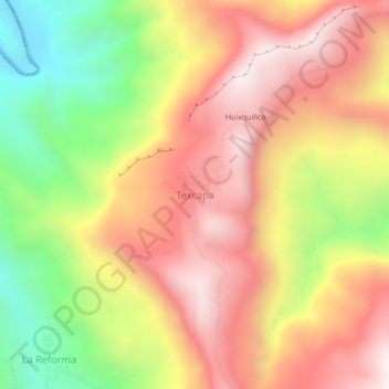
Name: Texcapa topographic map, elevation, terrain.
Location: Texcapa, Tepehuacán de Guerrero, Hidalgo, México (21.07111 -98.87389 21.11111 -98.83389)
Average elevation: 2,612 ft
Minimum elevation: 774 ft
Maximum elevation: 4,075 ft
Other topographic maps
Click on a map to view its topography, its elevation and its terrain.
Coyutla
México > Hidalgo > Tepehuacán de Guerrero > Coyutla
Coyutla, Tepehuacán de Guerrero, Hidalgo, México
Average elevation: 3,343 ft