
Thank you for supporting this site ❤️
Make a donation
Make a donation
Gear up for your next adventure:
As an Amazon Associate, this site earns from qualifying purchases at no extra cost to you.
Campisong topographic map
Click on the map to display elevation.
Thank you for supporting this site ❤️
Make a donation
Make a donation
Gear up for your next adventure:
As an Amazon Associate, this site earns from qualifying purchases at no extra cost to you.
About this map
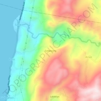
Name: Campisong topographic map, elevation, terrain.
Location: Campisong, Ginatilan, Cebu, Central Visayas, 6028, Philippines (9.58707 123.31412 9.62707 123.35412)
Average elevation: 1,001 ft
Minimum elevation: -3 ft
Maximum elevation: 2,329 ft
Thank you for supporting this site ❤️
Make a donation
Make a donation
Gear up for your next adventure:
As an Amazon Associate, this site earns from qualifying purchases at no extra cost to you.