
翠香街道 topographic map
Interactive map
Click on the map to display elevation.
About this map
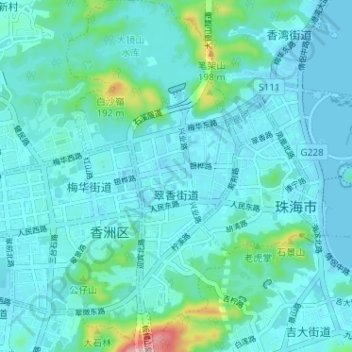
Name: 翠香街道 topographic map, elevation, terrain.
Location: 翠香街道, 香洲区, 珠海市, 广东省, 519000, 中国 (22.24919 113.53030 22.30831 113.56877)
Average elevation: 108 ft
Minimum elevation: -10 ft
Maximum elevation: 843 ft
Other topographic maps
Click on a map to view its topography, its elevation and its terrain.