
Cantagal topographic map
Interactive map
Click on the map to display elevation.
About this map
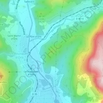
Name: Cantagal topographic map, elevation, terrain.
Average elevation: 1,060 ft
Minimum elevation: 774 ft
Maximum elevation: 1,903 ft
Other topographic maps
Click on a map to view its topography, its elevation and its terrain.
Mas Colombier
France > Occitanie > Hérault > Lunas > Mas Colombier
Mas Colombier, Lunas, Béziers, Hérault, Occitanie, France métropolitaine, 34650, France
Average elevation: 1,188 ft