
St. Clement topographic map
Interactive map
Click on the map to display elevation.
About this map
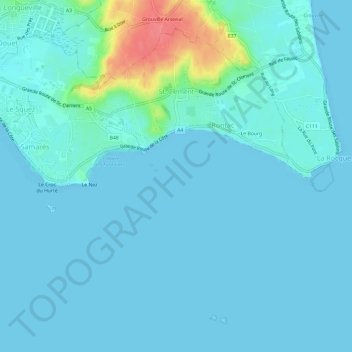
Name: St. Clement topographic map, elevation, terrain.
Location: St. Clement, Jersey (49.14787 -2.09674 49.18059 -2.03722)
Average elevation: 26 ft
Minimum elevation: 0 ft
Maximum elevation: 213 ft
Other topographic maps
Click on a map to view its topography, its elevation and its terrain.