
Las Trojes topographic map
Interactive map
Click on the map to display elevation.
About this map
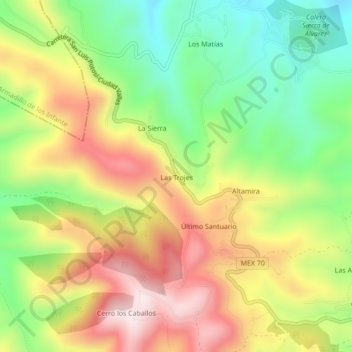
Name: Las Trojes topographic map, elevation, terrain.
Location: Las Trojes, Zaragoza, San Luis Potosí, México (22.06131 -100.66272 22.10131 -100.62272)
Average elevation: 7,736 ft
Minimum elevation: 6,877 ft
Maximum elevation: 8,717 ft
Other topographic maps
Click on a map to view its topography, its elevation and its terrain.
Las Aguilas
México > San Luis Potosí > Zaragoza
Las Aguilas, Zaragoza, San Luis Potosí, México
Average elevation: 7,087 ft
Villa de Zaragoza
México > San Luis Potosí > Zaragoza
Villa de Zaragoza, Zaragoza, San Luis Potosí, México
Average elevation: 6,650 ft