
Waldprechting topographic map
Interactive map
Click on the map to display elevation.
About this map
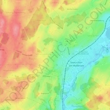
Name: Waldprechting topographic map, elevation, terrain.
Average elevation: 1,811 ft
Minimum elevation: 1,650 ft
Maximum elevation: 1,969 ft
Other topographic maps
Click on a map to view its topography, its elevation and its terrain.
Seewalchen
Österreich > Salzburg > Bezirk Salzburg-Umgebung > Seekirchen am Wallersee > Seewalchen
Seewalchen, Seekirchen am Wallersee, Bezirk Salzburg-Umgebung, Salzburg, 5201, Österreich
Average elevation: 1,759 ft