
洪安涧河 topographic map
Interactive map
Click on the map to display elevation.
About this map
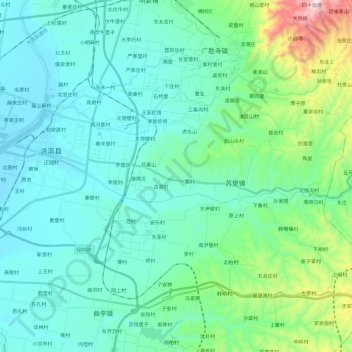
Name: 洪安涧河 topographic map, elevation, terrain.
Location: 洪安涧河, 洪洞县, 临汾市, 山西省, 中国 (36.22316 111.63533 36.25231 111.87477)
Average elevation: 1,962 ft
Minimum elevation: 1,437 ft
Maximum elevation: 4,501 ft