Geolocate

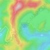
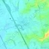
Catmon topographic map

Click on the map to display elevation.

About this map
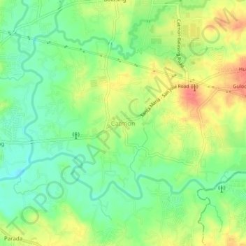
Name: Catmon topographic map, elevation, terrain.

Location: Catmon, Bulacan, Central Luzon, 3022, Philippines (14.80958 120.98406 14.84958 121.02406)

Average elevation: 102 ft

Minimum elevation: 16 ft

Maximum elevation: 210 ft

Other topographic maps

Click on a map to view its topography, its elevation and its terrain.
Malolos River

Philippines > Bulacan > Malolos > Teachers Village

Average elevation: 13 ft

Angat Dam

Philippines > Bulacan

Average elevation: 833 ft

Liciada

Philippines > Bulacan > Bustos

Average elevation: 69 ft

Malawak

Philippines > Bulacan > Bustos

Average elevation: 112 ft

Encanto

Philippines > Bulacan

Average elevation: 190 ft

Ciudad de Victoria

Philippines > Bulacan > Bocaue

Average elevation: 36 ft

Buisan

Philippines > Bulacan > Bustos

Average elevation: 56 ft

Pulilan

Philippines > Bulacan

The municipality is generally of flat topography. Eleven (11) of its barangays are bounded by the Angat River. The rest are flat irrigated rice lands. Soil types vary from sandy loam to clay loam which makes the municipality suitable to a wide range of agricultural products.

Average elevation: 33 ft
San Miguel

Philippines > Bulacan

Average elevation: 118 ft

Cambaog

Philippines > Bulacan > Bustos

Average elevation: 46 ft

Balagtas River

Philippines > Bulacan > Balagtas

Average elevation: 23 ft

Poblacion

Philippines > Bulacan > Bustos

Average elevation: 56 ft

Gear up for your next adventure:

🌡️Portable Weather Meter - Track weather conditions on the trail
🔦Powerful Headlamps - Ultra-bright hands-free lighting for night navigation
🔥Fast-Boil Camping Stoves - Efficient cooking systems for quick trail meals
🗺️Topographic Maps - Detailed topo maps for hiking, exploring and outdoor navigation
🛰️Handheld GPS Units - Professional satellite navigators for precise backcountry mapping

As an Amazon Associate, this site earns from qualifying purchases at no extra cost to you.