
Tokoy topographic map
Interactive map
Click on the map to display elevation.
About this map
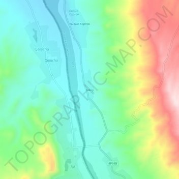
Name: Tokoy topographic map, elevation, terrain.
Location: Tokoy, Kadamjay District, Kyrgyzstan (40.11756 71.06414 40.15756 71.10414)
Average elevation: 3,304 ft
Minimum elevation: 2,910 ft
Maximum elevation: 4,117 ft