Geolocate

Dunham topographic map

Click on the map to display elevation.

About this map
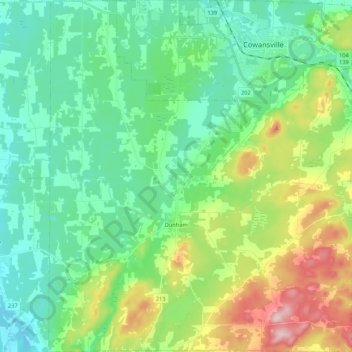
Name: Dunham topographic map, elevation, terrain.

Location: Dunham, Brome-Missisquoi, Estrie, Quebec, J0E 1M0, Canada (45.07598 -72.87824 45.22643 -72.68763)

Average elevation: 512 ft

Minimum elevation: 246 ft

Maximum elevation: 1,211 ft

Other topographic maps

Click on a map to view its topography, its elevation and its terrain.

Iron Hill

Canada > Quebec > Brome-Missisquoi > Lac-Brome

Average elevation: 804 ft

Gear up for your next adventure:

❄️Traction Cleats - Prevent slips on icy trails during winter hikes
🧼Biodegradable Camping Soap - Eco‑friendly soap for outdoor hygiene
🔊Portable Camp Speaker - Music and alerts at camp
🪄Magnetic Compass - Accurate compass for navigation
🥄Camping Utensil Set - Lightweight utensils for outdoor meals

As an Amazon Associate, this site earns from qualifying purchases at no extra cost to you.