
Runanga Lake topographic map
Interactive map
Click on the map to display elevation.
About this map
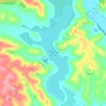
Name: Runanga Lake topographic map, elevation, terrain.
Average elevation: 240 ft
Minimum elevation: 95 ft
Maximum elevation: 502 ft
Other topographic maps
Click on a map to view its topography, its elevation and its terrain.
Oingo Lake
Oingo Lake, Pirau Road, Omahu, Hastings District, Hawke's Bay, 4175, New Zealand
Average elevation: 125 ft
Te Roto Kare
Te Roto Kare, State Highway 50, Kingsley Chatham, Omahu, Hastings District, Hawke's Bay, 4175, New Zealand
Average elevation: 121 ft