
Sainte-Enimie topographic map
Interactive map
Click on the map to display elevation.
About this map
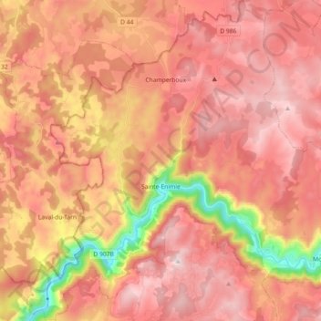
Name: Sainte-Enimie topographic map, elevation, terrain.
Average elevation: 2,949 ft
Minimum elevation: 1,467 ft
Maximum elevation: 3,766 ft
Other topographic maps
Click on a map to view its topography, its elevation and its terrain.
Castelbouc
Frankreich > Okzitanien > Lozère > Gorges du Tarn Causses > Sainte-Enimie
Castelbouc, Sainte-Enimie, Gorges du Tarn Causses, Florac, Lozère, Okzitanien, Metropolitanes Frankreich, 48210, Frankreich
Average elevation: 2,671 ft