
Town of Kentville topographic map
Interactive map
Click on the map to display elevation.
About this map
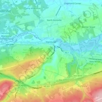
Name: Town of Kentville topographic map, elevation, terrain.
Average elevation: 210 ft
Minimum elevation: 3 ft
Maximum elevation: 709 ft
Other topographic maps
Click on a map to view its topography, its elevation and its terrain.
Woodville
Canada > Nova Scotia > Kings County > Woodville
Woodville, Municipality of the County of Kings, Kings County, Nova Scotia, B0P 1V0, Canada
Average elevation: 177 ft