Arbaz topographic map
Click on the map to display elevation.
Arbaz
The municipality is located in the Sion district, at an elevation of between 830 and 2,886 m (2,723 and 9,469 ft). Until 1877 it was part of the municipality of Ayent. The village of Arbaz was partially destroyed by fire in 1924, but has been rebuilt. Almost half of the houses in the village are vacation homes. It is situated on the north bank of the Rhône River.
About this map
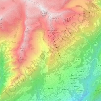
Name: Arbaz topographic map, elevation, terrain.
Location: Arbaz, Sion, Wallis, 1974, Switzerland (46.26372 7.35024 46.34049 7.39863)
Average elevation: 5,643 ft
Minimum elevation: 1,755 ft
Maximum elevation: 9,459 ft
Other topographic maps
Click on a map to view its topography, its elevation and its terrain.