
FELDA Kampung Sertik topographic map
Interactive map
Click on the map to display elevation.
About this map
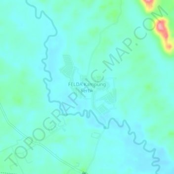
Name: FELDA Kampung Sertik topographic map, elevation, terrain.
Location: FELDA Kampung Sertik, Bentong, Pahang, 28610, Malaysia (3.48244 102.01007 3.52244 102.05007)
Average elevation: 220 ft
Minimum elevation: 151 ft
Maximum elevation: 581 ft