
Strömsund topographic map
Interactive map
Click on the map to display elevation.
About this map
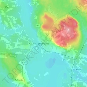
Name: Strömsund topographic map, elevation, terrain.
Location: Strömsund, Jämtland County, Region Norrland, 833 31, Sweden (63.81167 15.51824 63.89167 15.59824)
Average elevation: 1,010 ft
Minimum elevation: 919 ft
Maximum elevation: 1,335 ft