
Ontario Park topographic map
Interactive map
Click on the map to display elevation.
About this map
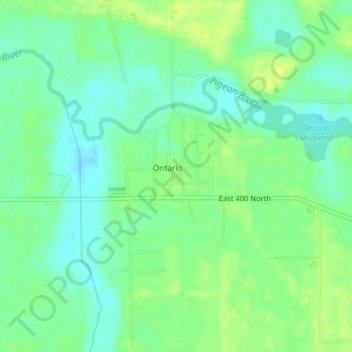
Name: Ontario Park topographic map, elevation, terrain.
Location: Ontario Park, Ontario, LaGrange County, Indiana, USA (41.70094 -85.38418 41.70211 -85.38269)
Average elevation: 883 ft
Minimum elevation: 856 ft
Maximum elevation: 909 ft