
Burg Berge topographic map
Interactive map
Click on the map to display elevation.
About this map
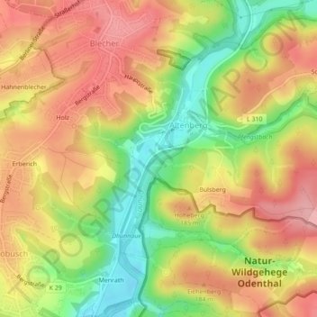
Name: Burg Berge topographic map, elevation, terrain.
Average elevation: 518 ft
Minimum elevation: 266 ft
Maximum elevation: 715 ft
Other topographic maps
Click on a map to view its topography, its elevation and its terrain.
Straßen
Deutschland > Nordrhein-Westfalen > Odenthal > Höffe > Straßen
Straßen, Höffe, Odenthal, Rheinisch-Bergischer Kreis, Nordrhein-Westfalen, 51519, Deutschland
Average elevation: 564 ft