
Saint Anne topographic map
Interactive map
Click on the map to display elevation.
About this map
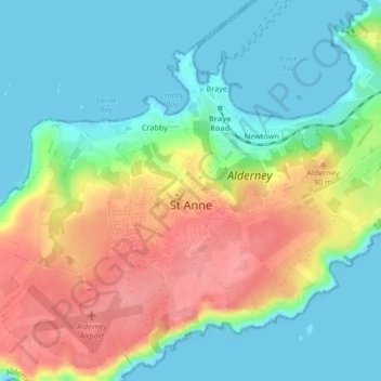
Name: Saint Anne topographic map, elevation, terrain.
Location: Saint Anne, Alderney, GY9 3UF, Guernsey (49.70979 -2.21301 49.72177 -2.19164)
Average elevation: 112 ft
Minimum elevation: -3 ft
Maximum elevation: 289 ft
Other topographic maps
Click on a map to view its topography, its elevation and its terrain.