
Municipality of Nisyros topographic map
Interactive map
Click on the map to display elevation.
About this map
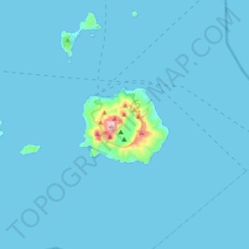
Name: Municipality of Nisyros topographic map, elevation, terrain.
Average elevation: 56 ft
Minimum elevation: 0 ft
Maximum elevation: 2,280 ft
Other topographic maps
Click on a map to view its topography, its elevation and its terrain.
Zipari
Greece > Aegean > Kos Regional Unit
Zipari, Municipality of Kos, Kos Regional Unit, South Aegean, Aegean, 853 00, Greece
Average elevation: 354 ft
Lambi
Greece > Aegean > Kos Regional Unit > Lambi
Lambi, Municipality of Kos, Kos Regional Unit, South Aegean, Aegean, 853000, Greece
Average elevation: 7 ft
Nisyros
Greece > Aegean > Kos Regional Unit > Emborios
Nisyros, Emborios, Municipality of Nisyros, Kos Regional Unit, South Aegean, Aegean, 85303, Greece
Average elevation: 413 ft