
Thank you for supporting this site ❤️
Make a donation
Make a donation
Gear up for your next adventure:
As an Amazon Associate, this site earns from qualifying purchases at no extra cost to you.
Lanuvio topographic map
Click on the map to display elevation.
Thank you for supporting this site ❤️
Make a donation
Make a donation
Gear up for your next adventure:
As an Amazon Associate, this site earns from qualifying purchases at no extra cost to you.
About this map
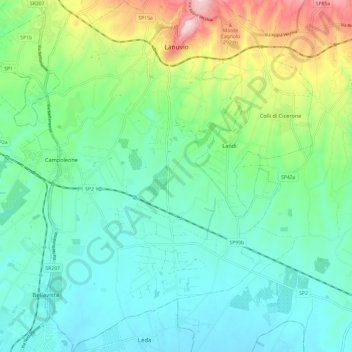
Name: Lanuvio topographic map, elevation, terrain.
Location: Lanuvio, Roma Capitale, Lazio, 00075, Italy (41.59633 12.65200 41.68638 12.73307)
Average elevation: 472 ft
Minimum elevation: 200 ft
Maximum elevation: 1,250 ft
Thank you for supporting this site ❤️
Make a donation
Make a donation
Gear up for your next adventure:
As an Amazon Associate, this site earns from qualifying purchases at no extra cost to you.