
Slaley topographic map
Interactive map
Click on the map to display elevation.
About this map
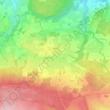
Name: Slaley topographic map, elevation, terrain.
Location: Slaley, Northumberland, North of Tyne, England, United Kingdom (54.88025 -2.10625 54.94252 -2.00054)
Average elevation: 689 ft
Minimum elevation: 190 ft
Maximum elevation: 1,257 ft
Other topographic maps
Click on a map to view its topography, its elevation and its terrain.
Holy Island of Lindisfarne
United Kingdom > England > Northumberland > Holy Island
Holy Island of Lindisfarne, Holy Island, Northumberland, North East England, England, United Kingdom
Average elevation: 3 ft