
Schildfeld topographic map
Interactive map
Click on the map to display elevation.
About this map
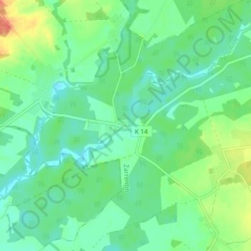
Name: Schildfeld topographic map, elevation, terrain.
Average elevation: 89 ft
Minimum elevation: 39 ft
Maximum elevation: 200 ft
Other topographic maps
Click on a map to view its topography, its elevation and its terrain.
Jesow
Deutschland > Mecklenburg-Vorpommern > Ludwigslust-Parchim > Vellahn
Jesow, Vellahn, Zarrentin, Ludwigslust-Parchim, Mecklenburg-Vorpommern, 19260, Deutschland
Average elevation: 151 ft
Banzin
Deutschland > Mecklenburg-Vorpommern > Ludwigslust-Parchim > Vellahn
Banzin, Vellahn, Zarrentin, Ludwigslust-Parchim, Mecklenburg-Vorpommern, 19260, Deutschland
Average elevation: 98 ft