
Untertweng topographic map
Interactive map
Click on the map to display elevation.
About this map
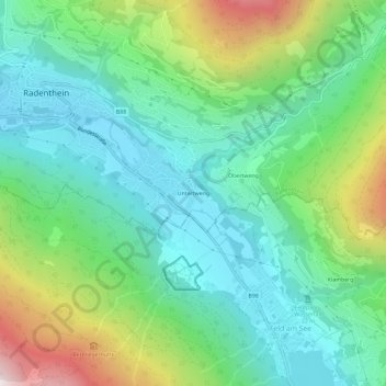
Name: Untertweng topographic map, elevation, terrain.
Average elevation: 3,409 ft
Minimum elevation: 2,297 ft
Maximum elevation: 6,129 ft
Other topographic maps
Click on a map to view its topography, its elevation and its terrain.
Döbriach
Oostenrijk > Karinthië > Bezirk Spittal an der Drau > Radenthein > Döbriach
Döbriach, Radenthein, Bezirk Spittal an der Drau, Karinthië, 9545, Oostenrijk
Average elevation: 3,018 ft