Geolocate

Candelas topographic map

Click on the map to display elevation.

About this map

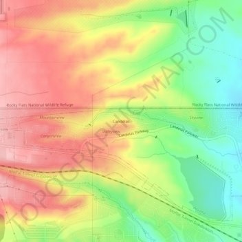
Name: Candelas topographic map, elevation, terrain.

Location: Candelas, Arvada, Jefferson County, Colorado, 80007, United States (39.84848 -105.21726 39.88848 -105.17726)

Average elevation: 5,909 ft

Minimum elevation: 5,633 ft

Maximum elevation: 6,152 ft

Jefferson County trails, hiking, mountain biking, running and outdoor activities

Other topographic maps

Click on a map to view its topography, its elevation and its terrain.

Gear up for your next adventure:

🥾Women's Hiking Boots - Top-rated trail boots with ankle support and superior grip
🥩Freeze-Dried Meals - Nutritious and lightweight food for remote expeditions
🧢Sun Protection Hats - Wide-brimmed and UPF-rated hats for high-altitude sun safety
📶Vehicle Signal Boosters - Improve reception in rural areas while driving to trailheads
🪶Fire Starter Kit - Reliable fire starter for survival and camping

As an Amazon Associate, this site earns from qualifying purchases at no extra cost to you.