
Grafelde topographic map
Interactive map
Click on the map to display elevation.
About this map
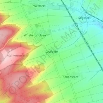
Name: Grafelde topographic map, elevation, terrain.
Average elevation: 686 ft
Minimum elevation: 440 ft
Maximum elevation: 1,086 ft
Other topographic maps
Click on a map to view its topography, its elevation and its terrain.
Adenstedt
Deutschland > Niedersachsen > Landkreis Hildesheim > Sibbesse
Adenstedt, Sibbesse, Landkreis Hildesheim, Niedersachsen, Deutschland
Average elevation: 732 ft