
Calusa Land Trust and Nature Preserve of Pine Island topographic map
Interactive map
Click on the map to display elevation.
About this map
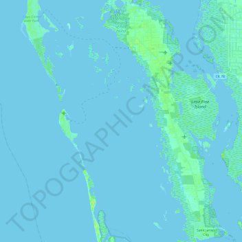
Name: Calusa Land Trust and Nature Preserve of Pine Island topographic map, elevation, terrain.
Average elevation: 3 ft
Minimum elevation: -7 ft
Maximum elevation: 30 ft
Other topographic maps
Click on a map to view its topography, its elevation and its terrain.
Cape Coral
United States > Florida > Lee County > Cape Coral
Cape Coral, Lee County, Florida, 33914-4648, United States
Average elevation: 10 ft
Coral Lakes
United States > Florida > Lee County > Cape Coral
Coral Lakes, Cape Coral, Lee County, Florida, 33909, United States
Average elevation: 20 ft
McDonough Canal
United States > Florida > Lee County > Cape Coral
McDonough Canal, Cape Coral, Lee County, Florida, 33991, United States
Average elevation: 10 ft
Sacremento Canal
United States > Florida > Lee County > Cape Coral
Sacremento Canal, Cape Coral, Lee County, Florida, 33904, United States
Average elevation: 13 ft