

Cossonay topographic map
Click on the map to display elevation.
Cossonay
Cossonay lies at an elevation of 562 m (1,844 ft) and 14 km (8.7 mi) northwest of Lausanne. The town stretches across the high plateau west of the Venoge, about 130 m (430 ft) above the valley floor, in the Gros de Vaud in the middle of the canton of Vaud.
About this map
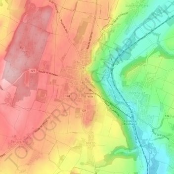
Name: Cossonay topographic map, elevation, terrain.
Location: Cossonay, District de Morges, Vaud, 1304, Switzerland (46.59312 6.48170 46.63212 6.52271)
Average elevation: 1,749 ft
Minimum elevation: 1,362 ft
Maximum elevation: 2,057 ft