
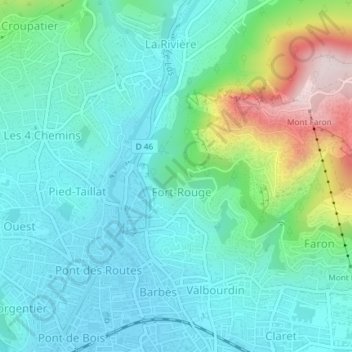
Fort du Grand-Saint-Antoine topographic map
Interactive map
Click on the map to display elevation.
About this map
Name: Fort du Grand-Saint-Antoine topographic map, elevation, terrain.
Average elevation: 397 ft
Minimum elevation: 23 ft
Maximum elevation: 1,670 ft
Other topographic maps
Click on a map to view its topography, its elevation and its terrain.
Toulon
France > Provence-Alpes-Côte d'Azur > Var > Toulon
Toulon, Var, Provence-Alpes-Côte d'Azur, Metropolitan France, 83800, France
Average elevation: 463 ft