
Thank you for supporting this site ❤️
Make a donation
Make a donation
Gear up for your next adventure:
As an Amazon Associate, this site earns from qualifying purchases at no extra cost to you.
Ossa topographic map
Click on the map to display elevation.
Thank you for supporting this site ❤️
Make a donation
Make a donation
Gear up for your next adventure:
As an Amazon Associate, this site earns from qualifying purchases at no extra cost to you.
About this map
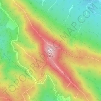
Name: Ossa topographic map, elevation, terrain.
Location: Ossa, Estremoz, Évora, 7170-120, Portugal (38.73945 -7.58402 38.73955 -7.58392)
Average elevation: 1,519 ft
Minimum elevation: 971 ft
Maximum elevation: 2,146 ft
Thank you for supporting this site ❤️
Make a donation
Make a donation
Gear up for your next adventure:
As an Amazon Associate, this site earns from qualifying purchases at no extra cost to you.