
National Park topographic map
Interactive map
Click on the map to display elevation.
About this map
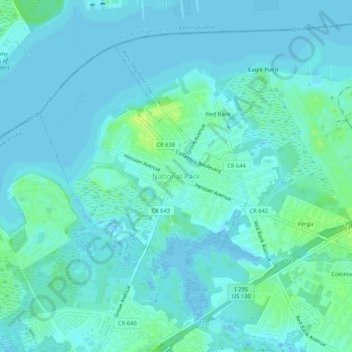
Name: National Park topographic map, elevation, terrain.
Location: National Park, Gloucester County, New Jersey, 08063, USA (39.84597 -75.19964 39.88597 -75.15964)
Average elevation: 13 ft
Minimum elevation: -7 ft
Maximum elevation: 52 ft