
Thank you for supporting this site ❤️
Make a donation
Make a donation
Gear up for your next adventure:
As an Amazon Associate, this site earns from qualifying purchases at no extra cost to you.
Shedol topographic map
Click on the map to display elevation.
Thank you for supporting this site ❤️
Make a donation
Make a donation
Gear up for your next adventure:
As an Amazon Associate, this site earns from qualifying purchases at no extra cost to you.
About this map
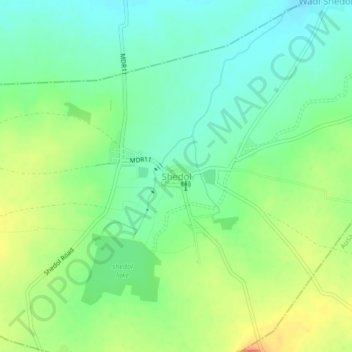
Name: Shedol topographic map, elevation, terrain.
Location: Shedol, Nilanga, Latur, Maharashtra, 413521, India (18.17870 76.62846 18.21870 76.66846)
Average elevation: 2,031 ft
Minimum elevation: 1,962 ft
Maximum elevation: 2,142 ft
Thank you for supporting this site ❤️
Make a donation
Make a donation
Gear up for your next adventure:
As an Amazon Associate, this site earns from qualifying purchases at no extra cost to you.