
Sissu topographic map
Interactive map
Click on the map to display elevation.
About this map
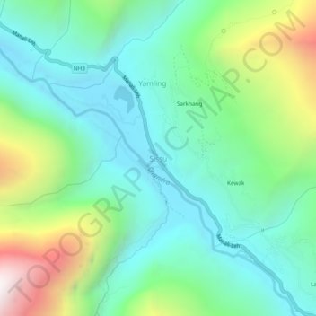
Name: Sissu topographic map, elevation, terrain.
Average elevation: 11,168 ft
Minimum elevation: 9,787 ft
Maximum elevation: 14,728 ft
Other topographic maps
Click on a map to view its topography, its elevation and its terrain.
Keylang
India > Himachal Pradesh > Lahul
Keylang, Lahul, Lahul and Spiti, Himachal Pradesh, 175132, India
Average elevation: 12,543 ft