
乌龟塔 topographic map
Interactive map
Click on the map to display elevation.
About this map
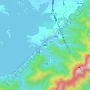
Name: 乌龟塔 topographic map, elevation, terrain.
Location: 乌龟塔, 千岛湖镇, 淳安县, 杭州市, 浙江省, 中国 (29.56844 119.12698 29.60844 119.16698)
Average elevation: 630 ft
Minimum elevation: 318 ft
Maximum elevation: 2,037 ft
Other topographic maps
Click on a map to view its topography, its elevation and its terrain.