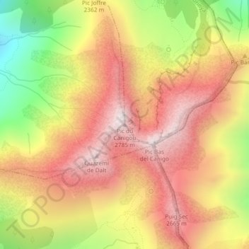
Pic du Canigou topographic map
Interactive map
Click on the map to display elevation.
About this map
Name: Pic du Canigou topographic map, elevation, terrain.
Average elevation: 7,720 ft
Minimum elevation: 5,932 ft
Maximum elevation: 8,986 ft

Click on the map to display elevation.
Name: Pic du Canigou topographic map, elevation, terrain.
Average elevation: 7,720 ft
Minimum elevation: 5,932 ft
Maximum elevation: 8,986 ft