
West Swanzey topographic map
Interactive map
Click on the map to display elevation.
About this map
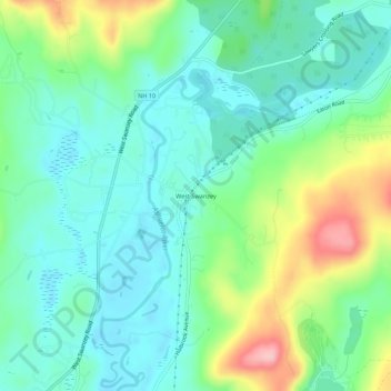
Name: West Swanzey topographic map, elevation, terrain.
Average elevation: 581 ft
Minimum elevation: 430 ft
Maximum elevation: 958 ft
Other topographic maps
Click on a map to view its topography, its elevation and its terrain.
East Swanzey
United States > New Hampshire > Cheshire County > Swanzey
East Swanzey, Swanzey, Cheshire County, New Hampshire, 03446, United States
Average elevation: 646 ft