
Melvin Village topographic map
Interactive map
Click on the map to display elevation.
About this map
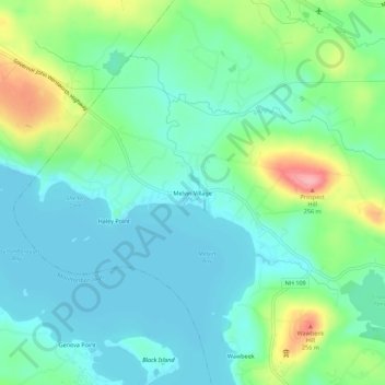
Name: Melvin Village topographic map, elevation, terrain.
Average elevation: 594 ft
Minimum elevation: 492 ft
Maximum elevation: 866 ft
Other topographic maps
Click on a map to view its topography, its elevation and its terrain.
Mirror Lake
United States > New Hampshire > Carroll County > Tuftonboro > Mirror Lake
Mirror Lake, Tuftonboro, Carroll County, New Hampshire, United States
Average elevation: 554 ft