
Thank you for supporting this site ❤️
Make a donation
Make a donation
Gear up for your next adventure:
As an Amazon Associate, this site earns from qualifying purchases at no extra cost to you.
Adishi topographic map
Click on the map to display elevation.
Thank you for supporting this site ❤️
Make a donation
Make a donation
Gear up for your next adventure:
As an Amazon Associate, this site earns from qualifying purchases at no extra cost to you.
About this map
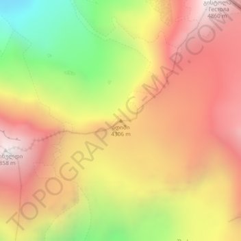
Name: Adishi topographic map, elevation, terrain.
Location: Adishi, Mestia Municipality, Samegrelo-Upper Svaneti, Georgia (43.03391 43.01091 43.03401 43.01101)
Average elevation: 13,527 ft
Minimum elevation: 10,413 ft
Maximum elevation: 15,863 ft
Thank you for supporting this site ❤️
Make a donation
Make a donation
Gear up for your next adventure:
As an Amazon Associate, this site earns from qualifying purchases at no extra cost to you.