
Urco Corral topographic map
Interactive map
Click on the map to display elevation.
About this map
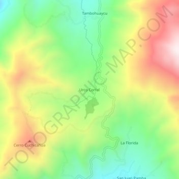
Name: Urco Corral topographic map, elevation, terrain.
Location: Urco Corral, Chillanes, Bolívar, Ecuador (-1.93727 -79.08781 -1.89727 -79.04781)
Average elevation: 8,766 ft
Minimum elevation: 7,644 ft
Maximum elevation: 10,223 ft
Other topographic maps
Click on a map to view its topography, its elevation and its terrain.
Sigsipamba
Ecuador > Bolívar > Chillanes > Chillanes
Sigsipamba, Chillanes, Bolívar, Ecuador
Average elevation: 8,143 ft