
La Enea topographic map
Interactive map
Click on the map to display elevation.
About this map
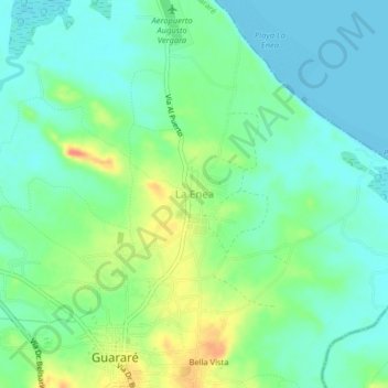
Name: La Enea topographic map, elevation, terrain.
Location: La Enea, Distrito Guararé, Los Santos, Panamá (7.81748 -80.29306 7.85748 -80.25306)
Average elevation: 52 ft
Minimum elevation: 0 ft
Maximum elevation: 161 ft