Jefferson topographic map
Interactive map
Click on the map to display elevation.
About this map
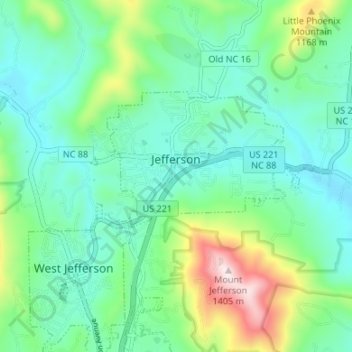
Name: Jefferson topographic map, elevation, terrain.
Average elevation: 3,212 ft
Minimum elevation: 2,759 ft
Maximum elevation: 4,583 ft

Click on the map to display elevation.
Name: Jefferson topographic map, elevation, terrain.
Average elevation: 3,212 ft
Minimum elevation: 2,759 ft
Maximum elevation: 4,583 ft